Geographic templates of Japan for maptile
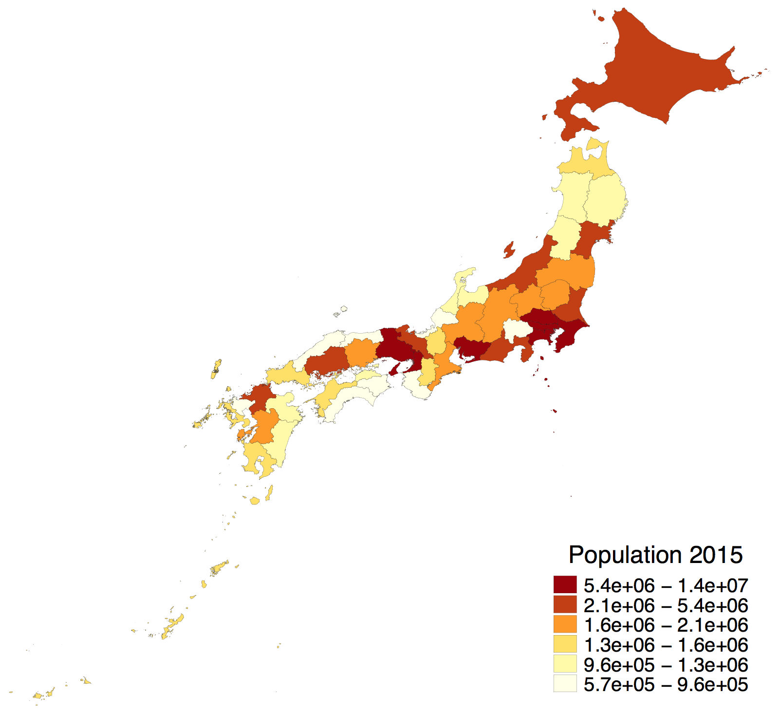
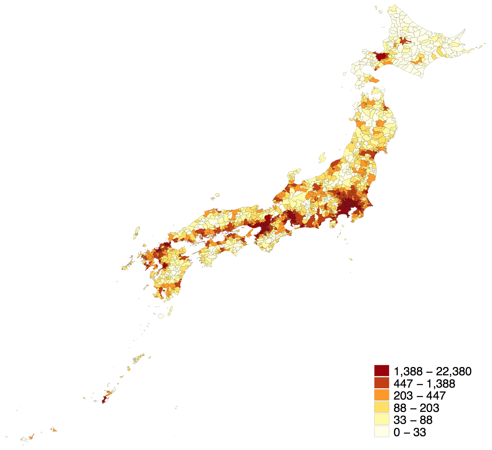
We have made the geographic templates of Japan available in maptile, a map creation program for stata. For example, you can make a map like this easily.
List of geographic templates of Japan
| Geographic template name | Description |
|---|---|
jpn_pref |
Prefectures |
jpn_mun2000 |
Municipalities as of October 1, 2000 |
jpn_mun2005 |
Municipalities as of October 1, 2005 |
jpn_mun2010 |
Municipalities as of October 1, 2010 |
jpn_mun2015 |
Municipalities as of October 1, 2015 |
The templates for Japan can be installed by running the commands:
maptile_install using "https://www.crepe.e.u-tokyo.ac.jp/material/geo_jpn_mun2000.zip"
maptile_install using "https://www.crepe.e.u-tokyo.ac.jp/material/geo_jpn_mun2005.zip"
maptile_install using "https://www.crepe.e.u-tokyo.ac.jp/material/geo_jpn_mun2010.zip"
maptile_install using "https://www.crepe.e.u-tokyo.ac.jp/material/geo_jpn_mun2015.zip"
What is maptile?
It is a stata program written by Michael Stepner that makes mapping easy. It divides the areas on the map into groups (such as state, county, province) and shades them according to the value of the variable. The map itself is drawn using geography templates, which can be downloaded here. Now, there are 18 templates of United States and Canada.
Once you install maptile and geographic templates, you can make your maps anytime without any further installation. Michael Stepner provides a detailed introduction of maptile at this slide deck. Here, we skip the introduction so please look at this page.
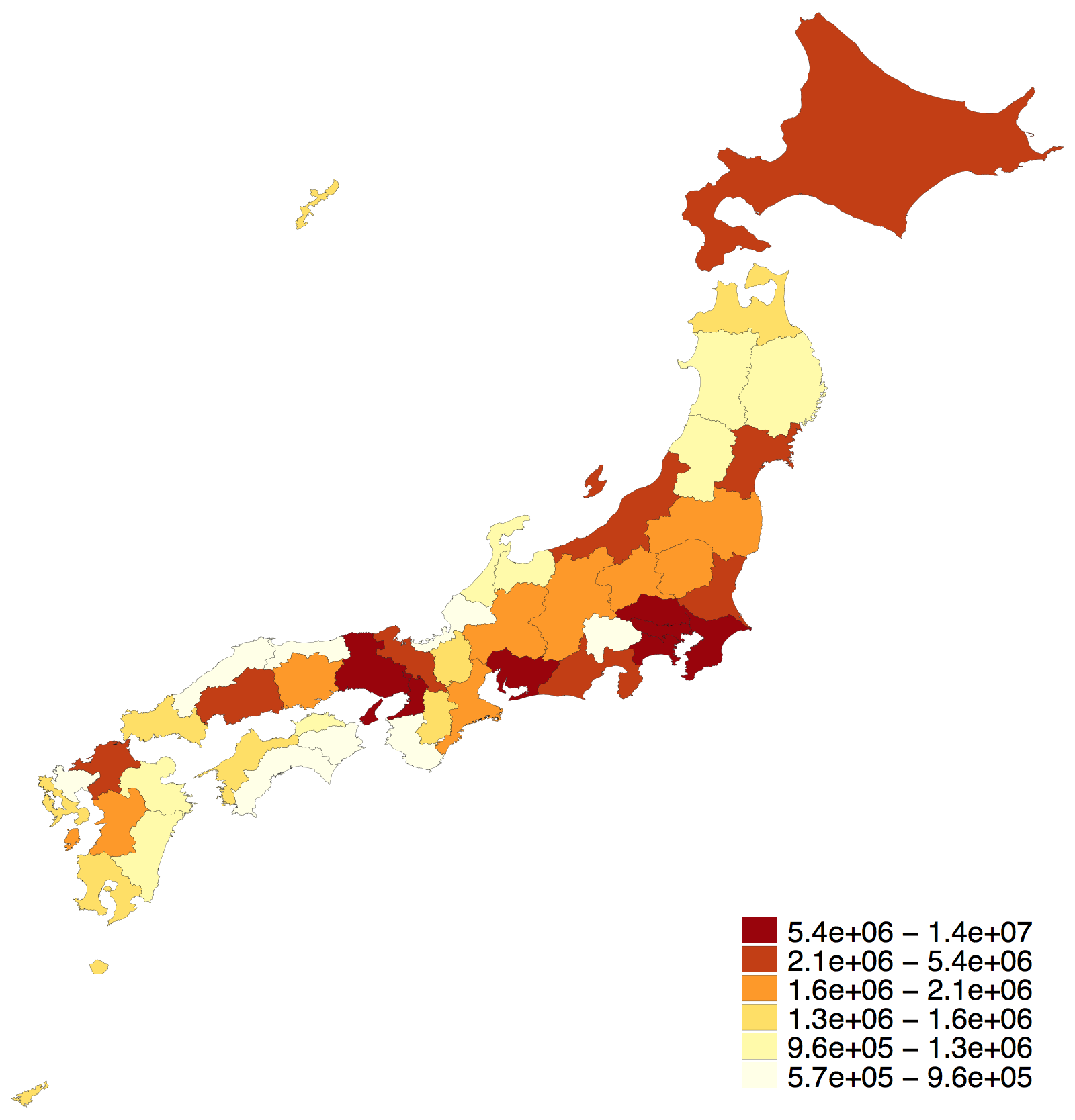
Geographic template: jpn_pref
jpn_pref generates a map of Japan prefectures. This template does not display Northern Territories and Ogasawara Village for ease of viewing.
Geographic ID
You need to check whether your dataset contains a proper geographic ID, which associates each observation with an area group. If no geographic ID is specified, the default ID will be used.
| Geographic ID | Description |
|---|---|
pref |
2-digit prefecture codes (numeric) |
prefname |
prefecture name in English |
prefname_jpn |
prefecture name in Japanese |
To-do-fu-ken (prefecture) identification code (JIS X0401) is used as prefecture code. JIS X0401 is the latter part of ISO 3166-2:JP after a hyphen, which is another common identification code of prefecture. Type names of prefectures (i.e., To, Fu, Ken) are removed from prefname and prefname_jpn (e.g., Tokyo-to → Tokyo).
Reference:
https://www.soumu.go.jp/denshijiti/code.html
https://www.iso.org/obp/ui/#iso:code:3166:JP
https://nlftp.mlit.go.jp/ksj-e/gml/codelist/PrefCd.html
Options
| Option | Description |
|---|---|
geoid(varname) |
It specifies the geographic ID variable to use; default is geoid(pref) |
simple |
It only displays large islands greater than 500 squared kilometers |
compressed |
It moves Okinawa prefecture to the top left of the map |
Option: simple
With this option, the map only displays large islands greater than 500 squared kilometers. Since there are tons of small islands in Japan, it makes your map simpler.
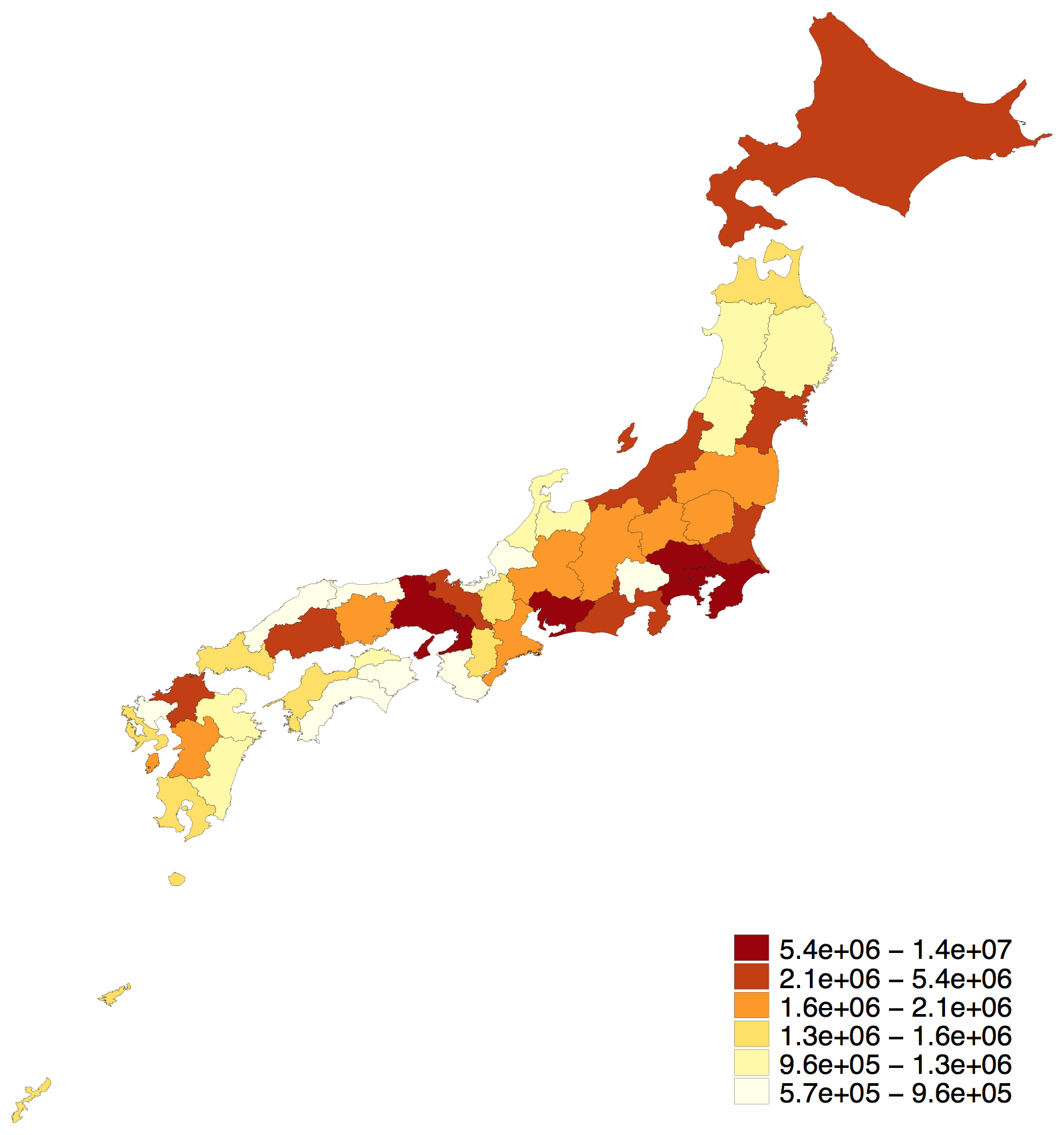
Option: compressed
This option moves Okinawa prefecture to the top left of the map, making it "compressed".
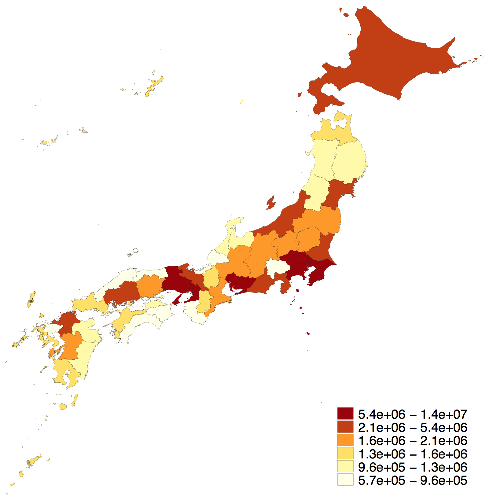
These options can be used together.
Geographic template: jpn_mun series
jpn_mun2000, ..., jpn_mun2015 generate a map of Japanese municipalities in each resepective year. The boundaries are based on the Population Census conducted on October 1 of each year. For example, jpn_mun2015 is the map of municipalities as of October 1, 2015. Those templates do not display the Northern Territories or Ogasawara Village for ease of viewing.
Data: population density from 2015 Population Census
Geographic ID
You need to check whether your dataset contains a proper geographic ID, which associates each observation with an area group.
| Geographic ID | Description |
|---|---|
mun |
5-digit municipality codes (numeric) |
Si-ku-cho-son (municipality) identification code (JIS X0402) is used as municipality code. Check digit is not included.
Reference:
https://www.soumu.go.jp/denshijiti/code.html
https://nlftp.mlit.go.jp/ksj-e/gml/codelist/AdminAreaCd.html
Options
| Option | Description |
|---|---|
compressed |
It moves Okinawa prefecture to the top left of the map |
district |
It outputs all ordinance-designated cities in district level |
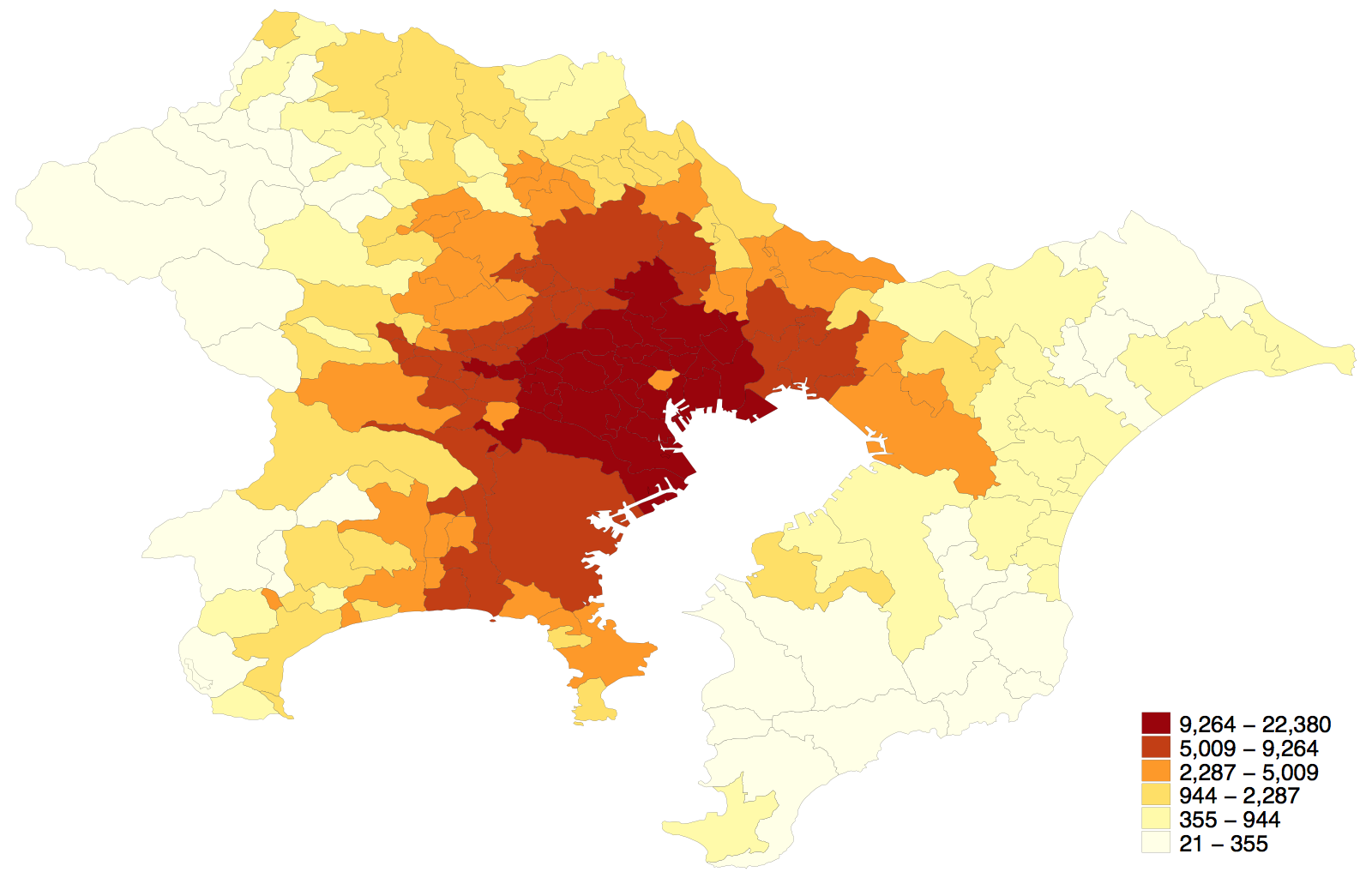
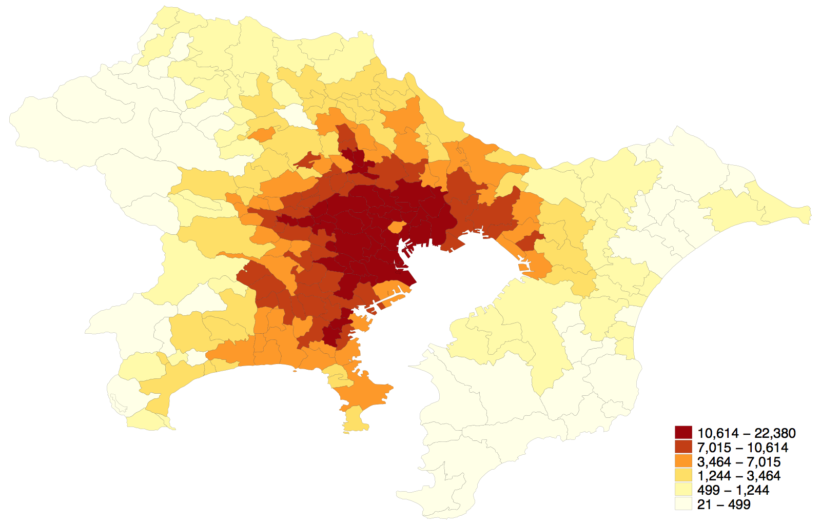
Option: district
There are 20 ordinance-designated cities in Japan as of 2018. Each ordinance-designated city has several administrative districts. As default, ordinance-designated cities are outputed in city level. This option outputs these cities in district level. Tokyo's 23 wards are ouptutted in ward level either with or without the option. A full list of ordinance-designated cities is avilable in this page.
maptile density if `area', geo(jpn_mun2015) mapif(`area') ///
twopt(legend(title("Population" "Density 2015", size(medsmall))))
maptile density if `area', geo(jpn_mun2015) mapif(`area') dist ///
twopt(legend(title("Population" "Density 2015", size(medsmall))))
Option: compressed
This option moves Okinawa prefecture to the top left of the map, making it compressed as same as jpn_pref.
Source
- National Land Information Division, National Spatial Planning and Regional Policy Bureau, MLIT of Japan, National Land Numerical Information download service
- National Land Numerical Information Administrative Zones Data (WGS; whole country; 2018)
- https://nlftp.mlit.go.jp/ksj/gml/datalist/KsjTmplt-N03-v2_3.html
- Takashi Kirimura, Municipality Map Maker Web version (MMM4W)
- Municipality shapefiles (WGS; lightweight size; October 1 of each year)
- https://www.tkirimura.com/mmm/
Reference
- Takashi Kirimura, Municipality Map Maker Web version (MMM4W)
- https://www.tkirimura.com/mmm/
Licence
This map is based on the Digital Map(Basic Geospatial Informaion) published by Geospatial Information Authority of Japan with its approval under the article30 of The Survey Act (Approval Number JYOU-SHI No.1575 2018). For secondary use of this geographic template, please refer to the website of Geospatial Information Authority of Japan. All code and documentation in this template is released into the public domain using the terms of the Unlicense.
If you would like to redistribute the geographic template with replication or processing, please refer to MMM4W. All code and documentation in this template is released into the public domain using the terms of the Unlicense.
Author
Chigusa Okamotookamoto.chigusa.econ@gmail.com